Advancing Europe’s Capacity to Monitor, Predict and Manage Soil Salinization for Adaptation and Mitigation with Novel Data and Tools
SaliNova is a Horizon Europe project developing new data, models and decision-support tools to monitor, predict and manage soil salinization across Europe.

Soil salinization threatens soil health, food production, biodiversity and climate resilience.
SaliNova brings together Earth observation, field data, hyperspectral sensing, AI modelling and stakeholder knowledge to turn complex soil data into practical action.
About Us
Why SaliNova?
Soil salinization is a growing threat to Europe’s soil health, food production, biodiversity and climate resilience. Yet, current knowledge is still fragmented across different datasets, monitoring methods and local studies.
SaliNova brings these pieces together by combining Earth observation, hyperspectral sensing, field measurements, climate modelling and physics-informed AI to better monitor, predict and manage soil salinity across Europe.

Our Mission
To support a Europe where soils are healthier, more resilient and better protected from the growing risks of salinization.

Our Vision
SaliNova combines Earth observation, field data, climate modelling and AI to monitor, predict and manage soil salinity across Europe.

Our Journey
From harmonised data and high-resolution maps to field validation and decision-support tools, SaliNova turns science into practical action for land managers, farmers and policymakers.

WorkFlow
SaliNova: A Roadmap for Europe's Saline-Resilient Soils
Multi-Source Data Harmonization
Integrating hyperspectral remote sensing with ground-truth measurements into standardized, FAIR-compliant European datasets.
Physics-Informed Predictive Modeling
Utilizing km-scale climate models and AI to project future soil salinity hotspots.
Participatory Field Validation
Testing sustainable land management practices across diverse agro-climatic demonstration sites in Europe.

Main Deliverables
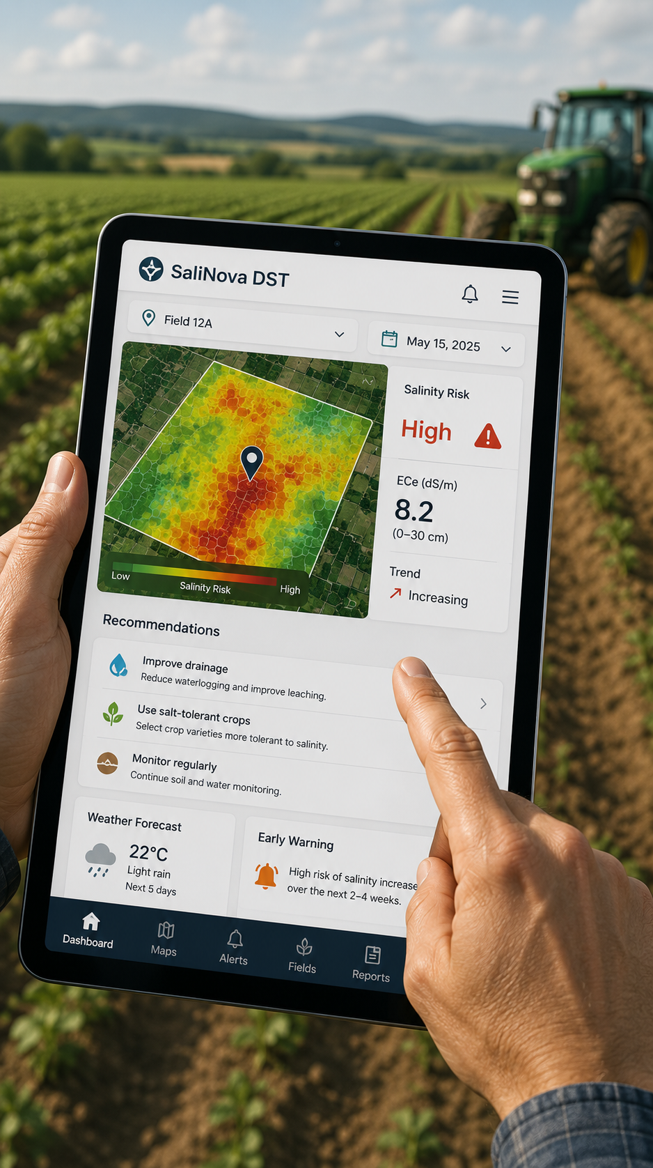
Stakeholder Decision Support Tool (DST)
A tablet or laptop dashboard in a farm setting, showing a salinity risk map, warning alert, and recommendation cards. No text overlay needed.
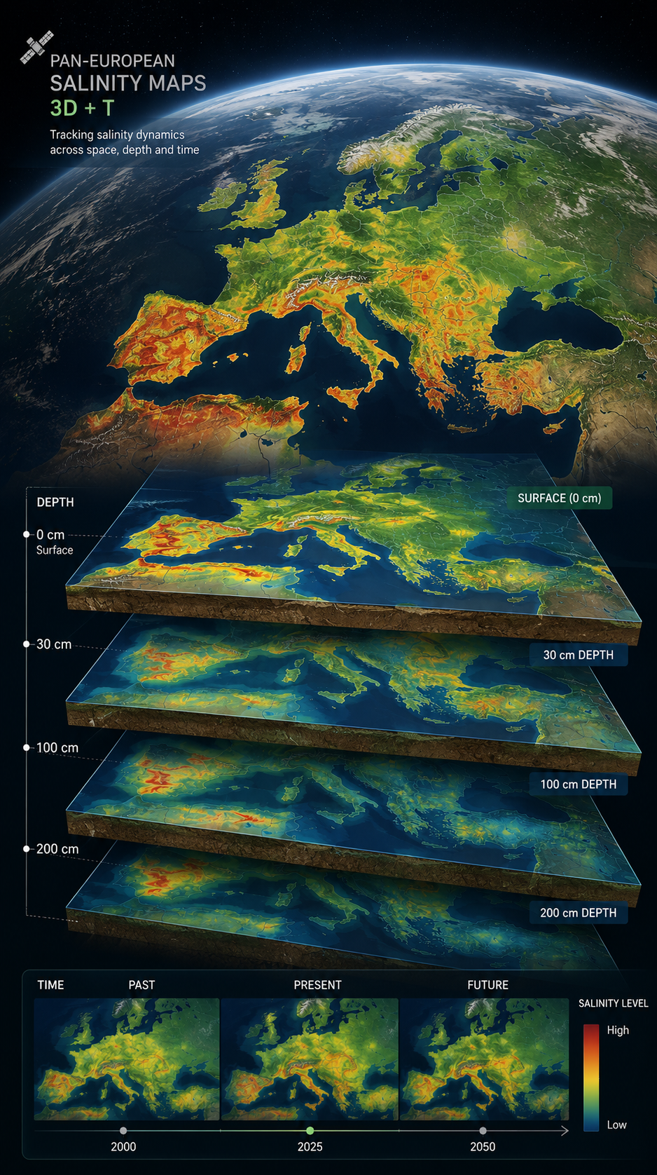
Pan-European 3D+T Salinity Maps
A satellite view over Europe with layered 3D soil-depth maps below it, using heatmap colours to show salinity variation across space, depth and time.

Global Policy and Literacy Resources
A clean desk scene with policy reports, educational booklet, tablet and soil/plant imagery, suggesting public education and policy guidance.


A European Partnership for
Soil Resilience
SaliNova brings together universities, research organisations, SMEs, public bodies and international organisations with expertise in soil science, remote sensing, AI, climate modelling, agronomy, governance and policy.